Slovenia's Topography, Nature & Climate
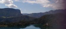
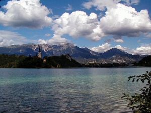
Slovenia occupies a small stretch of land south of the Eastern Alps right in the heart of Europe. Although the country is comparatively small, it offers a rich natural diversity. In the west, Slovenia has a 50 km long share of the Adriatic Sea coast. The northern part is characterised by the Alps, with the Julian Alps in the north-west as the highest mountain range in Slovenia. There, the distinctive, 2,864 metres high Mt. Triglav marks Slovenia's highest summit. The area between the capital →Ljubljana and the Adriatic Sea is dominated by a large karst plateau, featuring the most extensive cave network in Europe. Scientists estimate that there are around 6,000 caves in the country. Naturally, you will also find other typical karst phenomena, eg "dolinas" (small, funnel shaped collapsed depressions), "ponors" (sinkholes, where rivers etc simply vanish) and others. Many of the technical terms describing karst phenomena such as the above-mentioned ponor and dolina were borrowed from the Slovenian language. For more information see also →Postojna.
| ||
| Julian Alps near Bled |
The eastern corner of Slovenia is rather flat - here, Slovenia has a small share of the large Pannonian plain. As everywehere, the climate corresponds to the topography, ie it's rather Mediterranean along the coastline, slightly continental in the east and almost subalpine in the mountains.
©2024 Europe-East.com
